StormZ Risk Assessment - Storms do not begin when they are named — they begin days earlier. → Live Storms Map
StormZ detects atmospheric instability patterns that precede storm formation
Water vapour and longwave radiation divergence.
Convection amplitude and late-stage spikes.
Rotational instability and structural persistence.
StormZ data forecasts in advance →View Signals
Early Warning Signals - Hurricane Melissa → Overview
Signals detect emerging storm systems at basin scale.
Basin coupling: Africa ↔ US East Coast — Outcome: Cyclone formation confirmed
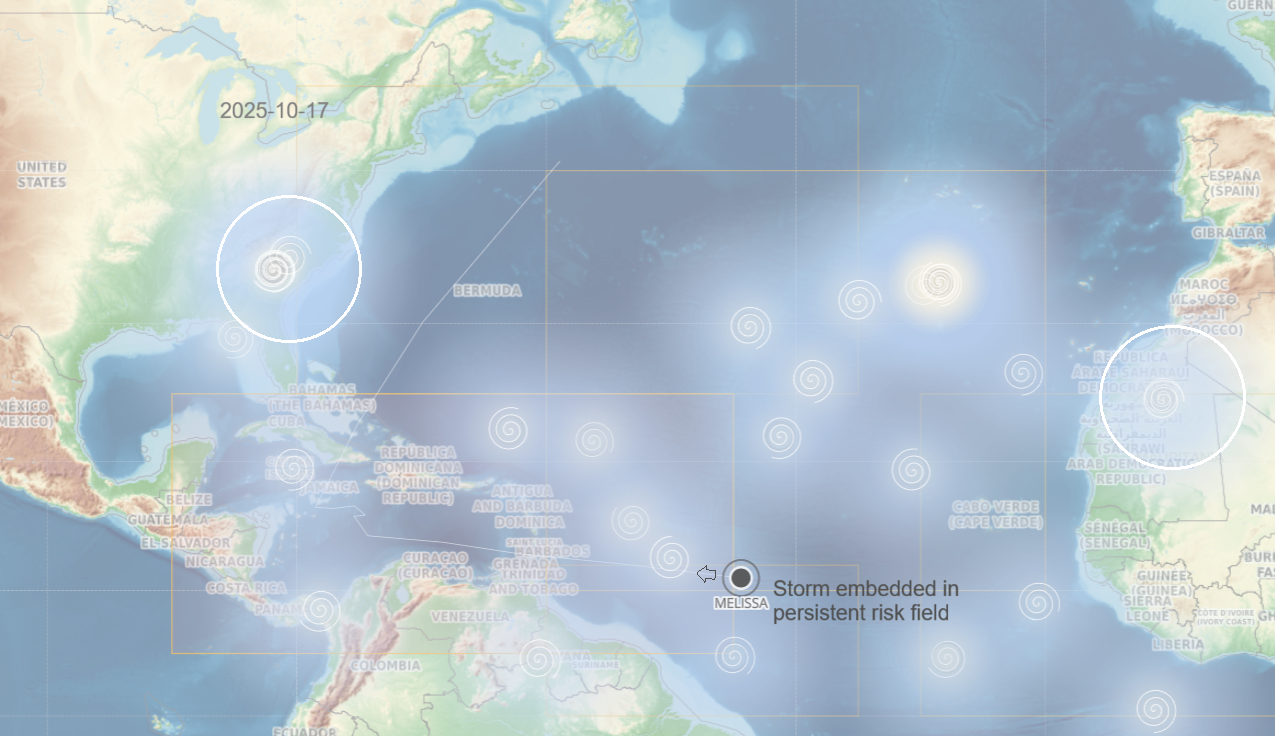
Persistent instability (Africa) — Persistent instability (US East Coast) — Basin coupling → elevated risk
Repeated observations show persistent risk signals emerging days before storm formation and genesis.
StormZ identifies early-stage atmospheric conditions that precede storm development. Daily updates for operational awareness and early-stage storm risk intelligence

Here at Trac-Car, we welcome your feedback. Get in touch.
→ Contact Details
How to read StormZ maps
 White spirals = rising storm risk.
Larger = more imminent. Clusters = potential storm pathways.
White spirals = rising storm risk.
Larger = more imminent. Clusters = potential storm pathways.
 Black circles = hurricanes.
Click for detailed analysis
Black circles = hurricanes.
Click for detailed analysis
Range: StormZ forecasts for last season up to present. Select date range of interest.
•
Analysis: Based on major storm history 2015-2025
•
Source: NOAA IBTrACS storm data, NASA and ERA satellite
water vapour and outgoing solar radiation metrics.